Skip to content

blog scape USA

Journey Through Reflections

Navigating Mountain Passes: A Must-Read for Travel Enthusiasts

mtnlook_02 Navigating Mountain Passes: A Must-Read for Travel Enthusiasts

Are you an avid traveler, exploring the breathtaking landscapes of the United States? Whether you’re driving a large RV or a heavy vehicle, the challenges of mountainous terrain are something every road adventurer should be prepared for. In this blog post, we introduce you to the Mountain Directory Ebooks, a valuable resource for anyone hitting the open road.

Unveiling the Mountain Directory Ebooks

Authored by RW, a seasoned traveler with a passion for mountains, the Mountain Directory Ebooks provide vital information for anyone driving a large or heavy vehicle. RW’s childhood experiences of towing a travel trailer across the western United States and Canada have laid the foundation for this comprehensive guide.

directories Navigating Mountain Passes: A Must-Read for Travel Enthusiasts

What's Inside?

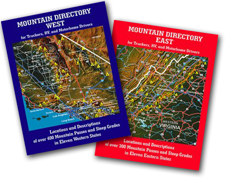
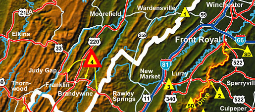
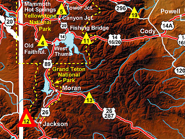
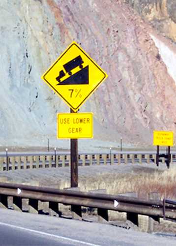
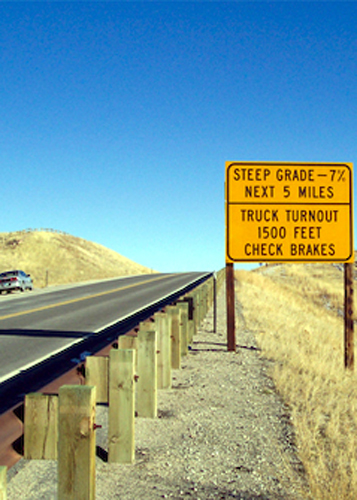
The Mountain Directory Ebooks, available since 1993, offer details about over 700 mountain passes and steep grades in 22 states. This invaluable resource informs you about the location, length, steepness, and other crucial details of each pass. With information on whether the road is two lane, three lane, or four lane, presence of escape ramps, switchbacks, sharp curves, and speed limits, you can make informed decisions about your route.

Real-Life Scenarios

The author shares personal anecdotes and stories, emphasizing the importance of being prepared for mountain driving. The old saying among over-the-road truckers holds true: “There are two kinds of drivers — those who’ve been in trouble on a mountain grade, and those who will be.” The Mountain Directory Ebooks aim to ensure you fall into the former category only in terms of knowledge and preparedness.

cb-virginia-kent-east-map Navigating Mountain Passes: A Must-Read for Travel Enthusiasts

Virginia/Kentucky East Section: US 33

4. US 33 (between Harrisonburg, VA and Judy Gap, WV.)

There are three summits along this stretch of US 33. The eastern summit is between Rawley Springs, VA and Brandywine, WV.  The east side is 4 miles of 8 to 9% grade. The west side is 4½ miles of 9% grade and both sides have continuous sharp curves and hairpin turns.  The highway is two lane on both sides.


The middle summit is between Oak Flat and Franklin, WV. The east side of this hill is 2½ miles of 8% with 25 mph curves.  The west side is about 3½ miles of much milder grade.  It is 4 to 5% over most of its length.  There are some sharp curves near the bottom.  The road is two lane on both sides of the hill.

The western summit is between Franklin and Judy Gap, WV.  It is 5 miles of steady 9% grade on both sides.  Both sides are two lane with sharp curves and hairpin turns.  Use caution on this road.

Colorado Section: Vail Pass

VAIL PASS elev. 10603′ (on I-70 east of Vail, CO)

The descent on the westbound side of Vail Pass is about 10 miles in length and begins at milepost 189 on I-70. One half mile west of the summit there are warning signs for westbound traffic–“Speed limit 45 mph for vehicles over 30,000 lbs.” and “Steep grade next 8 miles–trucks stay in lower gear.”  The next mile is rolling hills.  Then there is a sign–“7% grade next 7 miles.”

The descent is steady at 7% and there are 3 advisory signs for the first runaway truck ramp which is about milepost 185 or 4 miles down from the summit.  The escape ramp is upsloping on the right.  The second runaway truck ramp is about milepost 182, which is 3¼ miles after the first escape ramp, or about 7¼ miles down from the summit.   There are several advisory signs before reaching it and it is an upsloping ramp on the right.  Don’t be fooled when the grade eases after the second escape ramp.  It soon goes back to 7% and doesn’t bottom out until 2½ miles after the second escape ramp or about milepost 179.

md_001-1 Navigating Mountain Passes: A Must-Read for Travel Enthusiasts

The eastbound descent from the summit of Vail Pass continues almost to the Frisco exit about 11 miles down the hill but the descent is not steady.  There are short steep sections followed by short sections of lesser grade.  The last half of the descent is 3-4% grade.  There are no escape ramps on the east side of the pass.

md_002 Navigating Mountain Passes: A Must-Read for Travel Enthusiasts

North Carolina Section: I-40

I-40 (between Black Mountain and Old Fort, NC)

By law, all trucks except pickups and vans are required to stop at the top of this hill and read the information posted about the eastbound descent ahead.  The top of the hill is near milepost 67 just east of Black Mountain.  The grade is posted as 5 miles of 6%.  It is a strong 6%.  There are three runaway truck ramps, all of which are short sand beds with sand piles at the end.  There is about a mile of grade left after the last escape ramp.   The westbound descent is about 1¼ mile of 6%.

Wyoming Section: Teton Pass

(on Wyoming Highway 22 west of Jackson, WY)

Teton Pass has sustained 10% grades on both sides of the summit.  An unusual feature is that both runaway truck ramps on the east side of the pass can be used only if the runaway truck crosses the oncoming lane of traffic.  There is a posted weight limit of 60,000 lbs. on this pass.

The westbound descent from the summit of Teton Pass begins with a 25 mph speed limit and a truck warning sign–“Steep grade–10% next 3 miles–use lower gear.” This grade warning is

cb-wyoming-map Navigating Mountain Passes: A Must-Read for Travel Enthusiasts

repeated a mile later.  About 2½ miles down from the summit the grade eases to 6-7% and the speed limit increases.  This grade continues for about 3-4 miles and eases near the Idaho state line.

The eastbound descent from the summit of Teton Pass starts with a truck warning sign–“Steep grade–10% next 5 1/2 miles–use lower gear.”  There are 20 mph curves near the top.  About 1/3 mile down from the summit is a sign–“Runaway truck ramp–2½ miles LEFT side.”  This warning is repeated several times as you approach the ramp.  To use the ramp you must cross the oncoming lane of traffic.  The ramp slopes uphill.

The second runaway truck ramp is about 1 mile after the first.  It, too, is on the left side and is an upsloping ramp.  At this point the grade begins to ease to about 6-7% and the speed limit increases.  The hill continues to the town of Wilson, which is about 5½ miles from the summit.

Why You Need It

The Mountain Directory Ebooks aren’t meant to discourage exploration but rather to equip you with knowledge about the conditions you might encounter. Whether you’re a trucker or an RVer, the challenges of weight, engine power, and braking in mountainous terrain are universal.

What Others Are Saying

Don’t just take our word for it. Reviews from reputable sources like Motorhome, Coast to Coast, and Highways highlight the practicality and usefulness of these directories for RVers and truckers alike.

md_001-3 Navigating Mountain Passes: A Must-Read for Travel Enthusiasts
md_005-1 Navigating Mountain Passes: A Must-Read for Travel Enthusiasts
md_008-1 Navigating Mountain Passes: A Must-Read for Travel Enthusiasts
md_002-2 Navigating Mountain Passes: A Must-Read for Travel Enthusiasts
md_010 Navigating Mountain Passes: A Must-Read for Travel Enthusiasts

Conclusion

In the world of travel, knowledge is your greatest ally. The Mountain Directory Ebooks provide a roadmap to safer and more enjoyable mountain driving. Whether you’re planning a cross-country road trip or simply want to be prepared for the unexpected, make sure to check out these invaluable resources.

Ready to dive in? Order your Mountain Directory Ebook now and embark on a journey filled with confidence and adventure!

Comments